The lower Weser and the Weser estuary
The lower Weser is that part of the river flowing between Bremen and Bremerhaven, joined by the Weser estuary downstream from Bremerhaven, extending to the position of the two lighthouses Roter Sand and Alte Weser. According to this general definition, the North Sea starts from there.
During the past centuries, the River Weser became more and more silted, caused by soil erosion in the headwater region. Seagoing vessels of the modest contemporary size were no longer able to call at Bremen from the 17th century on. In the 19th century, the draught of the lower Weser was no more than two metres. This was reason enough for the foundation of Bremerhaven in 1827.
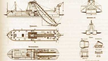
While the new and emerging city developed more and more into a significant overseas port, activities were instigated to link Bremen itself once more to international ocean shipping. Headed by the Bremen engineer Ludwig Franzius (1832-1903), one of the most prominent hydraulics experts of the time, the lower Weser was deepened to five metres draught from 1887 to 1895 (the so-called “Unterweserkorrektion” project. 40 Million gold marks and a large fleet of specialized vessels (dredgers, barges and other types) were necessary to realize this enterprise). Together with the construction of the Kiel Canal (which took place simultaneously) the Unterweserkorrektion project was one of the most comprehensive hydraulics works in imperial Germany before the First World War.
In the years that followed further steps were taken:
| Depth | Time of construction |
| 7 Metres | 1913 to 1916 |
| 7 Metres (extension) | 1922 to 1924 |
| 8 Metres | 1925 to 1929 |
| 8,7 Metres | 1953 to 1958 |
| 9 Metres | 1974 to 1982 |
Making the lower Weser navigable again, the Weser estuary (draught around 1907: 8 metres) had to be deepened as well:
| Depth | Time of construction |
| 10 Metres | 1922 to 1927 |
| 11 Metres | 1950 to 1966 |
| 12 Metres | 1968 to 1971 |
| 14 Metres | 1998 to 1999 |
| |

