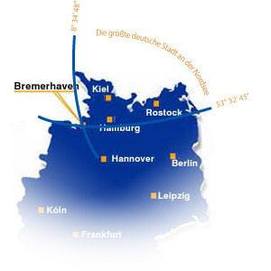
General Information

Geographical Coordinates
of Bremerhaven-City Center:
53° 32’ 45’’ North Latitude
8° 34’ 48’’ East Longitude
| Total area (incl. overseas port area) (Updated 01.01.2016) | 101.53 km² |
| Area Bremerhaven (without overseas port area) | 93.82 km² |
| Area Overseas Port Area | 7.71 km² |
| Average elevation of Bremerhaven | 2.6 m AMSL |
| Highest elevation in Bremerhaven (Debstedter Weg/Brunnenstraße) | 11.4 m AMSL |
| Lowest point in Bremerhaven (without water surfaces) (Rohrniederung) | -0.5 m AMSL |
| Highest elevation in Bremerhaven (artifical) (Deponie Grauer Wall) | 28.5 m AMSL |
| Biggest expansion in north-south direction | ca. 15.4 km |
| Largest expansion of Bremerhaven in east-west direction | ca. 11.1 km |
| Zoning (incl. overseas port area) (Updated 01.01.2016) | |
| Buildings and enclosed areas | 1,599 ha |
| Industrial and commercial zones | 1,448 ha |
| Traffic zones | 1,161 ha |
| Recreation zones | 701 ha |
| Agricultural zones | 1,847 ha |
| Forests | 377 ha |
| Water | 2,722 ha |
| Other zones | 297 ha |
| Population (Updated 31.12.2015*) | |
| all | 119,937 |
| male | 60,791 |
| female | 59,46 |
Twin Cities
Bremerhaven has six Twin Cities.
* Population size by local update (provisional figures)
