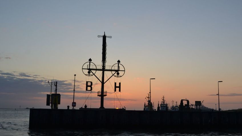
The Semaphore
A semaphore indicates optically the wind speed and direction. This was important especially before electronic communications revolutionized shipping. In 1893, a semaphore (height: about 20 metres) was installed at Hoher Weg Lighthouse (built 1856) in the Weser estuary. Two hands, each 4.5 metres long, indicate the directions, six smaller indicators (length 1.5 metres) the gale forces 1 to 12, each standing for two gale forces.
This semaphore was decommissioned in 1972 and one year later Hohe Weg lighthouse was automated. In 1976, the rusted gear of the semaphore had to be dismantled; the most important parts of it were handed over to the German Maritime Museum in Bremerhaven.
The local maritime historical society finally took the initiative to restore the semaphore, using original parts from the museum. The City of Bremerhaven supported the project, which was realized in time for the “Sail 2005” windjammer meeting. The gear was erected on the northern edge of the entrance to Neuer Hafen basin. Every two hours, the German Meteorological Service transmits the current wind data on the German North Sea islands of Borkum and Helgoland. This information is then indicated by the semaphore.

